An Integrated Ecosystem Model for Alaska and Northwest Canada
|
The Integrated Ecosystem Model is designed to help resource managers understand the nature and expected rate of landscape change. Maps and other products generated by the IEM illustrate how arctic and boreal landscapes are expected to alter due to climate-driven changes to vegetation, disturbance, hydrology, and permafrost. The products also provide resource managers with an understanding of the uncertainty in the expected outcomes.
|
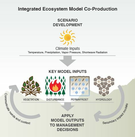
Examples of IEM outputs include vegetation (land cover, treeline extent, growth and carbon dynamics, growing season length), disturbance (wildfire, secondary succession, thermokarst), permafrost (active layer depth, ground temperature, subsidence), and hydrology (soil moisture, thaw lake dynamics, patterned ground dynamics). Potential secondary impact model applications include habitat assessment, fire risk, access for subsistence, and identifying hotspots of change. Image: IEM Project
|